Dosiye:Zambia - Location Map (2011) - ZMB - UNOCHA.svg

Dosiye nyirizina (SVG file, nominally 254 × 254 pixels, file size: 389 KB)
Incamake
| Umwirondoro |
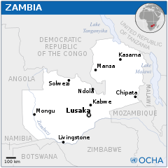
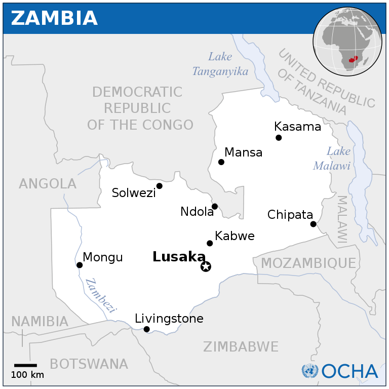
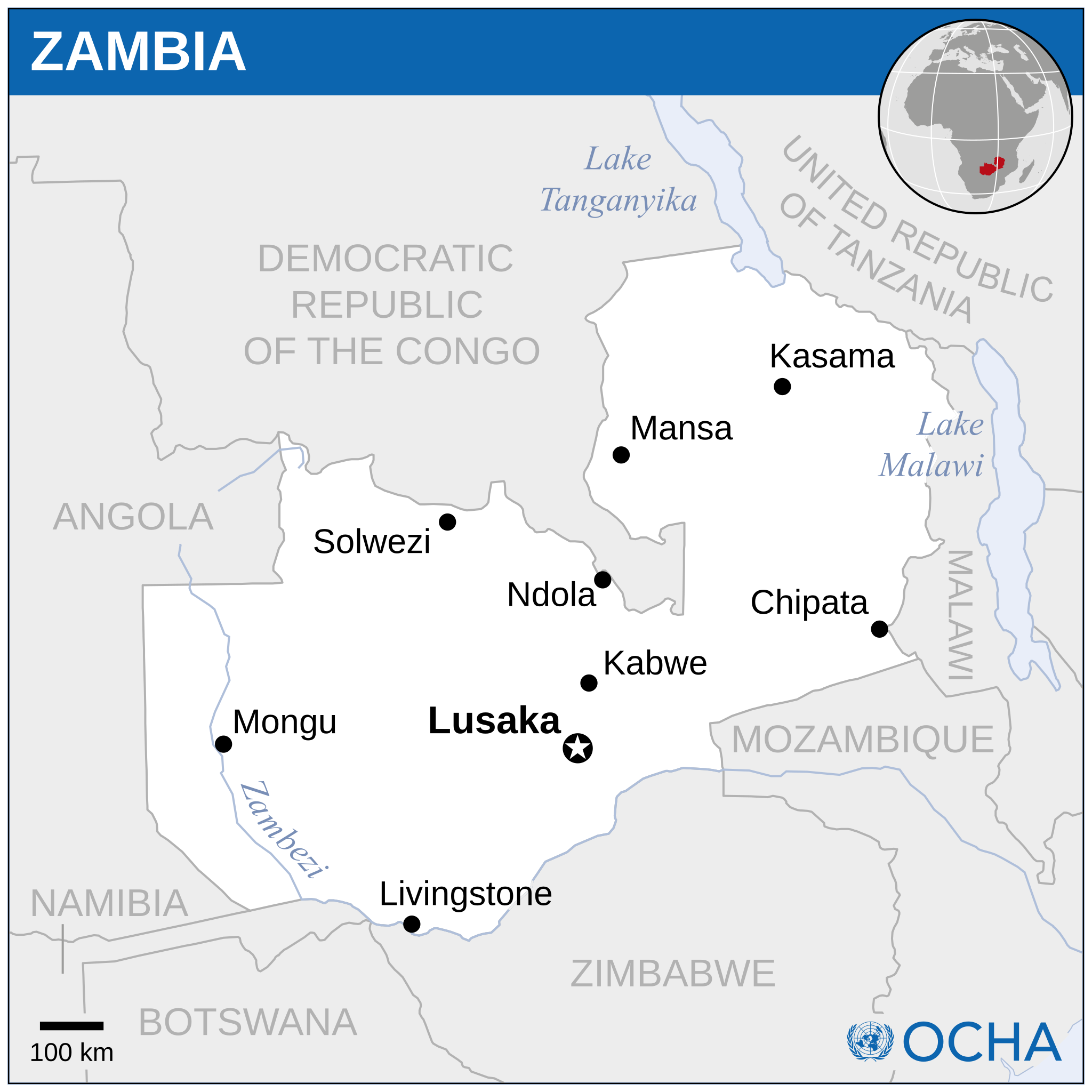
English: Locator map of Zambia. |
| Itariki | |
| Inkomoko |
English: Zambia Locator Map (ReliefWeb) |
| Umwanditsi | |
| SVG genesis |

_-_ZMB_-_UNOCHA.svg)
_-_ZMB_-_UNOCHA.svg&wpForReUpload=1&wpUploadDescription=%5B%5BCommons%3AWatermarks%23Dealing%20with%20watermarked%20images%7Cwatermark%20removed%5D%5D)
_-_ZMB_-_UNOCHA.svg&action=edit&withJS=MediaWiki:RemoveWatermarktemplate.js)
Uruhushya
- Ufite umudendezo:
- gusangiza – to copy, distribute and transmit the work
- to remix – gutangira ibikorwa
- Under the following conditions:
- umurimo – You must give appropriate credit, provide a link to the license, and indicate if changes were made. You may do so in any reasonable manner, but not in any way that suggests the licensor endorses you or your use.
 This map is part of a collection of 216 free country maps, created by the UN Office for the Coordination of Humanitarian Affairs (OCHA), to be used in print, web or broadcast products.
The ReliefWeb Location Maps released here are maps that highlight a country, its capital, major populated places and the surrounding regions. Attribution Requirements
Using the map without modifications: ensure that the sources and the disclaimer are below the map. Credit as follows: "Credit: OCHA". For use with alteration: remove the OCHA logo and disclaimer following any modification to the map, but keep the data sources as mentioned below the map. Credit the modified map as follows: "Based on OCHA map". You are responsible for the content of your map. We are keen to receive your feedback and hear how you used OCHA's maps. We would be grateful if you would notify us by e-mail and share your work with us. UN Disclaimer
The designations employed and the presentation of material of this map do not imply the expression of any opinion whatsoever on the part of the Secretariat of the United Nations concerning the legal status of any country, territory, city or area or of its authorities or concerning the delimitation of its frontiers or boundaries. |
Amateka ya dosiye
Kanda kwitariki/n'isaha kugirango ufungure dosiye nkuko yagaragaye cyagihe.
| Itariki/Isaha | Ifoto ntoya | Ibipimo | Umukoresha | Comment | |
|---|---|---|---|---|---|
| muri iki gihe | 20:52, 30 Ukuboza 2022 | | 254 × 254 (389 KB) | Wikijahnn | File uploaded using svgtranslate tool (https://svgtranslate.toolforge.org/). Added translation for ca. |
| 10:05, 7 Nyakanga 2022 |  | 254 × 254 (386 KB) | Nutshinou | Reverted to version as of 01:22, 8 May 2014 (UTC) | |
| 13:58, 10 werurwe 2019 |  | 235 × 235 (359 KB) | Nutshinou | Removed the logo | |
| 01:22, 8 Gicurasi 2014 |  | 254 × 254 (386 KB) | UN OCHA maps bot | == {{int:filedesc}} == {{Information |description={{en|1=Locator map of Zambia.}} |date=2011 |source={{en|1=[http://reliefweb.int/map/zambia/zambia-location-map-2011 Zambia Locator Map (ReliefWeb)]}} |author={{en|1=[[w:en:United Nations... |
Ikoreshwa rya dosiye
Ibi bikurikira 3 imikoreshereze yarwo iyi dosiye:
Ikoreshwa rya dosiye rusange
Izindi wiki zikurikira zikoresha iyi dosiye:
- Ikoreshwa kuri azb.wikipedia.org
- Ikoreshwa kuri bh.wikipedia.org
- Ikoreshwa kuri bn.wikipedia.org
- Ikoreshwa kuri ca.wikipedia.org
- Ikoreshwa kuri es.wikipedia.org
- Ikoreshwa kuri ha.wikipedia.org
- Ikoreshwa kuri hu.wikipedia.org
- Ikoreshwa kuri id.wikipedia.org
- Ikoreshwa kuri lfn.wikipedia.org
- Ikoreshwa kuri pl.wikipedia.org
- Ikoreshwa kuri sco.wikipedia.org
- Ikoreshwa kuri zh-yue.wikipedia.org
_-_ZMB_-_UNOCHA.svg)