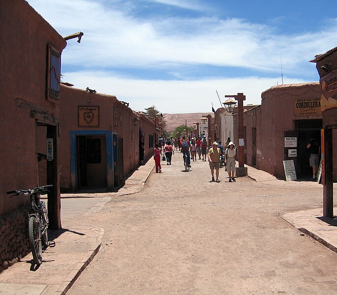
Dosiye:San Pedro de Atacama (street view).jpg

Ingano yiri shusho:686 × 600 pixels. Indi ingano zagutse: 275 × 240 pixels | 549 × 480 pixels | 879 × 768 pixels | 1.171 × 1.024 pixels | 2.218 × 1.939 pixels.
Dosiye nyirizina (2.218 × 1.939 pixels, file size: 2,49 MB, MIME type: image/jpeg)
Amateka ya dosiye
Kanda kwitariki/n'isaha kugirango ufungure dosiye nkuko yagaragaye cyagihe.
| Itariki/Isaha | Ifoto ntoya | Ibipimo | Umukoresha | Comment | |
|---|---|---|---|---|---|
| muri iki gihe | 22:37, 22 Mutarama 2011 |  | 2.218 × 1.939 (2,49 MB) | Entropy1963 | {{Information |Description ={{en|1=San Pedro de Atacama (street view)}} |Source ={{own}} |Author =Entropy1963 |Date =2008-12-24 |Permission ={{PD-self}} |other_versions = }} {{Coord|-22.911134|-68.20134 |
Ikoreshwa rya dosiye
Ibi bikurikira abakoresha urupapuro iyi dosiye:
Ikoreshwa rya dosiye rusange
Izindi wiki zikurikira zikoresha iyi dosiye:
- Ikoreshwa kuri an.wikipedia.org
- Ikoreshwa kuri arz.wikipedia.org
- Ikoreshwa kuri ay.wikipedia.org
- Ikoreshwa kuri bat-smg.wikipedia.org
- Ikoreshwa kuri bcl.wikipedia.org
- Ikoreshwa kuri be-tarask.wikipedia.org
- Ikoreshwa kuri be.wikipedia.org
- Ikoreshwa kuri bg.wikipedia.org
- Ikoreshwa kuri bi.wikipedia.org
- Ikoreshwa kuri bo.wikipedia.org
- Ikoreshwa kuri bpy.wikipedia.org
- Ikoreshwa kuri br.wikipedia.org
- Ikoreshwa kuri bs.wikipedia.org
- Ikoreshwa kuri bxr.wikipedia.org
- Ikoreshwa kuri cbk-zam.wikipedia.org
- Ikoreshwa kuri ceb.wikipedia.org
- Ikoreshwa kuri chy.wikipedia.org
- Ikoreshwa kuri en.wikipedia.org
- Ikoreshwa kuri fa.wikipedia.org
- Ikoreshwa kuri fi.wikipedia.org
- Ikoreshwa kuri fr.wikipedia.org
- Ikoreshwa kuri zh.wikipedia.org