Dosiye:Jamaica relief location map.jpg

Ingano yiri shusho:800 × 385 pixels. Indi ingano zagutse: 320 × 154 pixels | 640 × 308 pixels | 1.024 × 493 pixels | 1.870 × 900 pixels.
Dosiye nyirizina (1.870 × 900 pixels, file size: 594 KB, MIME type: image/jpeg)
| Umwirondoro |
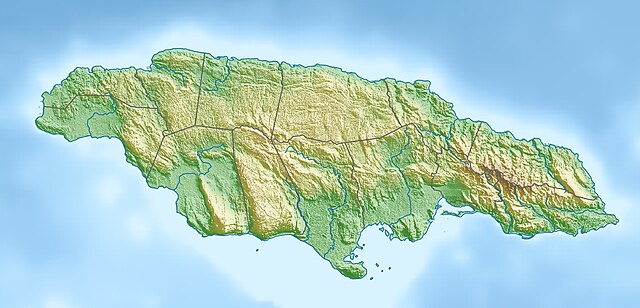
Deutsch: Physische Positionskarte von Jamaika
Quadratische Plattkarte, N-S-Streckung 105 %. Geographische Begrenzung der Karte:
English: Physical location map of Jamaica
Equirectangular projection, N/S stretching 105 %. Geographic limits of the map:
|
| Itariki | |
| Inkomoko | Own work, using map data from administrative map by NordNordWest. The relief was created from SRTM-3 relief data |
| Umwanditsi | Carport |
| Permission (Reusing this file) |
This file is licensed under the Creative Commons Attribution-Share Alike 3.0 Unported license.
|
| Other versions |
|

Amateka ya dosiye
Kanda kwitariki/n'isaha kugirango ufungure dosiye nkuko yagaragaye cyagihe.
| Itariki/Isaha | Ifoto ntoya | Ibipimo | Umukoresha | Comment | |
|---|---|---|---|---|---|
| muri iki gihe | 15:59, 1 Mata 2010 | | 1.870 × 900 (594 KB) | Carport | {{Information |Description={{de|Physische Positionskarte von {{w|Jamaika|3=de}}}} Quadratische Plattkarte, N-S-Streckung 105 %. Geographische Begrenzung der Karte: * N: 18.7° N * S: 17.6° N * W: 78.5° W * O: 76.1° W {{en|Physical location map of {{w|J |
Ikoreshwa rya dosiye
Ibi bikurikira abakoresha urupapuro iyi dosiye:
Ikoreshwa rya dosiye rusange
Izindi wiki zikurikira zikoresha iyi dosiye:
- Ikoreshwa kuri ar.wikipedia.org
- Ikoreshwa kuri arz.wikipedia.org
- Ikoreshwa kuri ast.wikipedia.org
- Ikoreshwa kuri az.wikipedia.org
- Ikoreshwa kuri be.wikipedia.org
- Ikoreshwa kuri bg.wikipedia.org
- Ikoreshwa kuri bn.wikipedia.org
- Ikoreshwa kuri bs.wikipedia.org
- Ikoreshwa kuri ca.wikipedia.org
- Ikoreshwa kuri ceb.wikipedia.org
- Ikoreshwa kuri ce.wikipedia.org
- Ikoreshwa kuri ckb.wikipedia.org
- Ikoreshwa kuri cs.wikipedia.org
- Ikoreshwa kuri da.wikipedia.org
- Ikoreshwa kuri de.wikipedia.org
- Ikoreshwa kuri de.wikivoyage.org
View more global usage of this file.