Dosiye:Kazakhstan (orthographic projection).svg

Size of this PNG preview of this SVG file: 553 × 553 pixels. Indi ingano zagutse: 240 × 240 pixels | 480 × 480 pixels | 768 × 768 pixels | 1.024 × 1.024 pixels | 2.048 × 2.048 pixels.
Dosiye nyirizina (SVG file, nominally 553 × 553 pixels, file size: 309 KB)
ҚАЗАҚСТАН
Incamake
| Umwirondoro |
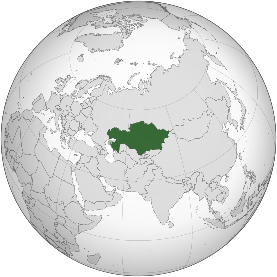
English: Kazakhstan |
||||
| Itariki | |||||
| Inkomoko |
S So2009
lberg J:
|
||||
| Umwanditsi | Turkish Flame | ||||
| Other versions |
.svg) |
||||
| SVG genesis |
.svg)

.svg)
.svg)
.svg)
.svg)
.svg)
.svg)
.svg)
.svg)
.svg)
.svg)
.svg)
.svg)
.svg)
.svg)
.svg)
.svg)
.svg)
.svg)
.svg)
.svg)
.svg)
.svg)
.svg)
.svg)
.svg)
.svg)
.svg)
.svg)
.svg)
.svg)
.svg)
.svg)
.svg)
.svg)
.svg)
.svg)
.svg)
.svg)
.svg)
.svg)
.svg)
.svg)
.svg)
.svg)
.svg)
.svg)
.svg)
.svg)
.svg)
.svg)
.svg)
.svg)
.svg)
.svg)
.svg)
.svg)
.svg)
.svg)
.svg)
.svg)
.svg)
.svg)
.svg)
.svg)
.svg)
.svg)
.svg)
.svg)
.svg)
.svg)
.svg)
.svg)
.svg)

.svg)

.svg)

.svg)
.svg)
.svg)
.svg)
.svg)
.svg)
.svg)


.svg)
.svg)
.svg)
.svg)
.svg)
.svg)
.svg)

.svg)
.svg)
.svg)
.svg)
.svg)
.svg)
.svg)
.svg)
.svg)

.svg)
.svg)
.svg)
.svg)
.svg)
.svg)
.svg)
_without_national_boundaries.svg)
.svg)
.svg)
.svg)
.svg)
.svg)
.svg)

.svg)
.svg)
.png)
.svg)
.svg)
.svg)
.svg)

.svg)
.svg)
.svg)
.svg)
.svg)
.svg)
.svg)
.svg)
.svg)
.svg)
.svg)

.svg)
.svg)
.svg)
.svg)
.svg)
.svg)
.svg)
.svg)
.svg)

.svg)
.svg)

.svg)
.svg)
.svg)
.svg)
.svg)
.svg)
.svg)
.svg)
.svg)
.svg)
.svg)
.svg)
.svg)
.svg)
.svg)
.svg)
.svg)
.svg)
.svg)
.svg)
.svg)
.svg)
.svg)
.svg)
.svg)
.svg)
.svg)
_-_Crimea_disputed.svg)
.svg)
.svg)
.svg)
.svg)
.svg)
.svg)
.svg)
.svg)
.svg)
.svg)
.svg)
_political.svg)
.svg)
.svg)
.svg)
.svg)
_-_Crimea_disputed_-_no_borders.svg)
.svg)
.svg)
.svg)
.svg)
.svg)
.svg)
.svg)
.svg)
.svg)
.svg)
.svg)

.svg)
.svg)
.svg)

.png)
.svg)
.svg)
.svg)
.svg)
.svg)
.svg)
.svg)
.svg)
.svg)
.svg)
.svg)
.svg)
.svg)
.svg)
.svg)
.svg)
.svg)
.svg)
.svg)
.svg)
.svg)
.svg)
.svg)
.svg)
.svg)
.svg)
.svg)
.svg)
.svg)
.svg)
.svg)
.svg)
.svg)
.svg)
.png)
.svg)
.svg)
.svg)
_(orthographic_projection).png)
.svg)
Uruhushya
I, the copyright holder of this work, hereby publish it under the following license:
This file is licensed under the Creative Commons Attribution 3.0 Unported license.
- Ufite umudendezo:
- gusangiza – to copy, distribute and transmit the work
- to remix – gutangira ibikorwa
- Under the following conditions:
- umurimo – You must give appropriate credit, provide a link to the license, and indicate if changes were made. You may do so in any reasonable manner, but not in any way that suggests the licensor endorses you or your use.
Amateka ya dosiye
Kanda kwitariki/n'isaha kugirango ufungure dosiye nkuko yagaragaye cyagihe.
| Itariki/Isaha | Ifoto ntoya | Ibipimo | Umukoresha | Comment | |
|---|---|---|---|---|---|
| muri iki gihe | 02:31, 5 Ukuboza 2015 | | 553 × 553 (309 KB) | Chronus | Reverted to version as of 23:38, 16 March 2015 (UTC) |
| 03:05, 20 Ugushyingo 2015 |  | 553 × 553 (348 KB) | Salmunete | Kazakhstan (dark green) in the EEU (light green) | |
| 23:38, 16 werurwe 2015 |  | 553 × 553 (309 KB) | Flappiefh | Removed Somaliland and Kosovo. Separated Western Sahara and Morroco. | |
| 12:32, 4 Kanama 2013 |  | 553 × 553 (313 KB) | Flappiefh | Added South Sudan. | |
| 17:10, 1 Ugushyingo 2008 |  | 541 × 541 (563 KB) | Turkish Flame~commonswiki | == Summary == {{Information |Description={{en|1=Kazakhstan}} |Source=Own work, {{Inkscape}}<br />[http://www.aquarius.geomar.de/omc/make_map.html Aquarius.geomar.de]<br />{{GFDL-GMT}} |Author=Turkish Flame |Date=1 November 2008 |Per |
Ikoreshwa rya dosiye
Ibi bikurikira abakoresha urupapuro iyi dosiye:
Ikoreshwa rya dosiye rusange
Izindi wiki zikurikira zikoresha iyi dosiye:
- Ikoreshwa kuri ace.wikipedia.org
- Ikoreshwa kuri af.wikipedia.org
- Ikoreshwa kuri alt.wikipedia.org
- Ikoreshwa kuri ang.wikipedia.org
- Ikoreshwa kuri arc.wikipedia.org
- Ikoreshwa kuri ar.wikipedia.org
- كازاخستان
- بوابة:العالم الإسلامي/دولة مختارة/أرشيف
- بوابة:العالم الإسلامي/دولة مختارة/22
- قائمة الدول ذات السيادة والأقاليم التابعة في آسيا
- معاملة المثليين في كازاخستان
- مستخدم:جار الله/قائمة صور مقالات العلاقات الثنائية
- العلاقات الأمريكية الكازاخستانية
- العلاقات الأنغولية الكازاخستانية
- العلاقات الكازاخستانية الكورية الجنوبية
- العلاقات الإريترية الكازاخستانية
- العلاقات السويسرية الكازاخستانية
- العلاقات الألمانية الكازاخستانية
- العلاقات الكازاخستانية الليختنشتانية
- العلاقات البوليفية الكازاخستانية
- العلاقات الكازاخستانية الموزمبيقية
- العلاقات الألبانية الكازاخستانية
- العلاقات البلجيكية الكازاخستانية
- العلاقات الإثيوبية الكازاخستانية
- العلاقات البيلاروسية الكازاخستانية
- العلاقات الطاجيكستانية الكازاخستانية
- العلاقات الروسية الكازاخستانية
- العلاقات الرومانية الكازاخستانية
- العلاقات الأرجنتينية الكازاخستانية
- العلاقات الغامبية الكازاخستانية
- العلاقات القبرصية الكازاخستانية
- العلاقات السيراليونية الكازاخستانية
- العلاقات الكازاخستانية النيبالية
- العلاقات الكازاخستانية الليبيرية
- العلاقات التشيكية الكازاخستانية
- العلاقات الكازاخستانية الميانمارية
- العلاقات الكازاخستانية الكندية
- العلاقات الزيمبابوية الكازاخستانية
- العلاقات الإسرائيلية الكازاخستانية
- العلاقات البالاوية الكازاخستانية
- العلاقات الكازاخستانية المالية
- العلاقات الكازاخستانية النيجيرية
- العلاقات اليمنية الكازاخستانية
- العلاقات الفانواتية الكازاخستانية
- العلاقات الغابونية الكازاخستانية
- العلاقات البنمية الكازاخستانية
- العلاقات الكازاخستانية الكوبية
- العلاقات الجورجية الكازاخستانية
- العلاقات التونسية الكازاخستانية
- العلاقات الكازاخستانية الكورية الشمالية
View more global usage of this file.
.svg)
.svg)